Hierarchy
county
barony
civil parish
townland
subunits
population centretownland
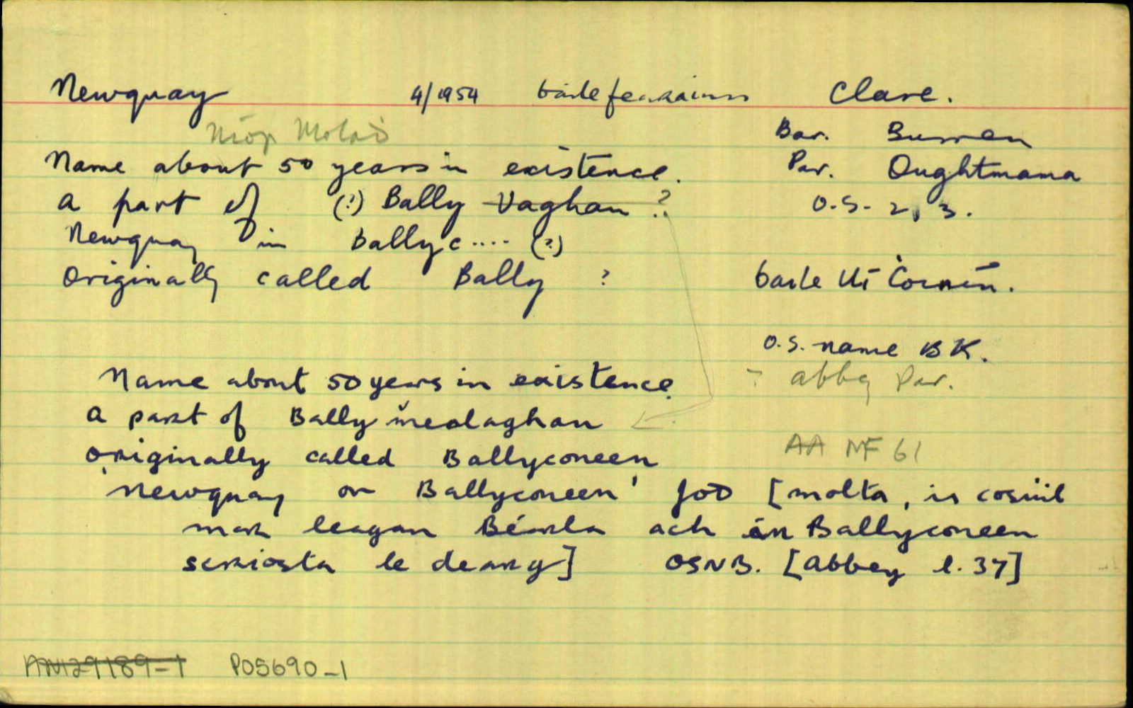
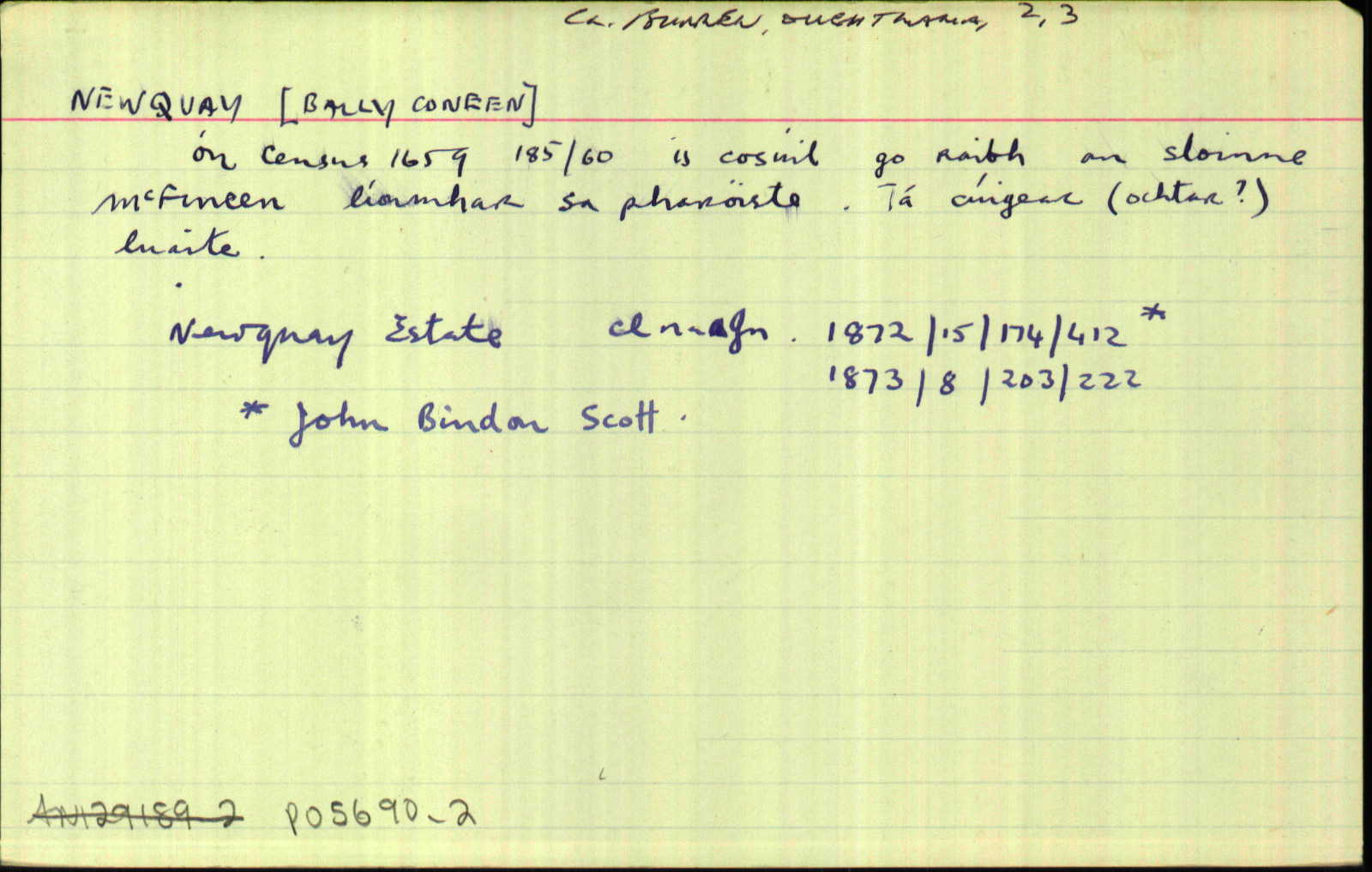
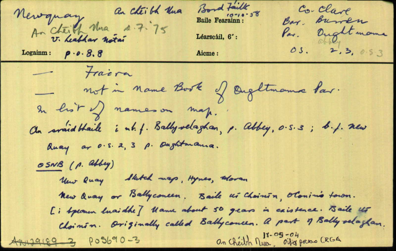
Newquay
(English)
Centrepoint
53.1553, -9.09742latitude, longitude
Irish Grid (with letter)
Computing...
Irish Grid (without letter)
Computing...
Irish Transverse Mercator (ITM)
Computing...
Archival records
Historical references
| 1839 |
[Newquay]
"One ancient fort named Faunaparkmore - one trigonometrical station, Burneen, 254 feet above the sea level - Burneen Hill about the centre of the townland covered with trees" [Desc. Rem., eolas sa bhreis ar thithe móra anseo];
|
Desc. Rem.:AL Leathanach: Cl001,37
|
| 1839 |
New Quay
|
BS:AL Leathanach: Cl001,37
|
| 1839 |
New Quay
|
Hynes, J.:AL Leathanach: Cl001,37
|
| 1839 |
New Quay
|
Moran, A.:AL Leathanach: Cl001,37
|
| 1839 |
New quay or Ballyconeen
|
OD:AL Leathanach: Cl001,37
|
| 1839 |
New quay
|
OD (corr.):AL Leathanach: Cl001,37
|
| 1839 |
Baile Ui Choinín
"Name about 50 years in existence" [pl]; "Originally called Ballyconeen" [pl]; "A part of Ballymealaghan" [pl];
|
pl:AL Leathanach: Cl001,37
|
| 1839 |
Baile Uí Choinín, 'O'Conin's town'
|
OD:AL Leathanach: Cl001,37
|
Please note: Some of the documentation from the archives of the Placenames Branch is available here. It indicates the range of research contributions undertaken by the Branch on this placename over the years. It may not constitute a complete record, and evidence may not be sequenced on the basis of validity. It is on this basis that this material is made available to the public.
Archival and research material provided on this site may be used, subject to acknowledgement. Issues regarding republication or other permissions or copyright should be addressed to logainm@dcu.ie.
Permanent link
https://www.logainm.ie/5690.aspxOpen data
Application programming interface (API)
Available under
Creative Commons Attribution 4.0 International (CC BY 4.0)
API key required to access data
Linked Logainm
Formats: RDF | RDF N3 | RDF JSON | RDF XML
Operated by Digital Repository of Ireland