Hierarchy
county
barony
civil parish
townland
townland
Tamhnaigh Uí Bhardáin
genitive: Thamhnaigh Uí Bhardáin
(Irish)
Tonywardan
(English)
Centrepoint
53.7453, -7.53155latitude, longitude
Irish Grid (with letter)
Computing...
Irish Grid (without letter)
Computing...
Irish Transverse Mercator (ITM)
Computing...
Archival records
Historical references
|
6 dhuine de shloinne ‘Bardon’ i mbar. Shrule i Cen. 453 (1659). Níl an sloinne luaite in aon bhar. eile sa chontae sa Census seo.
|
||
| 1582 |
Tromry (Teige O Daly)
|
F Leathanach: 3855
|
| 1604 |
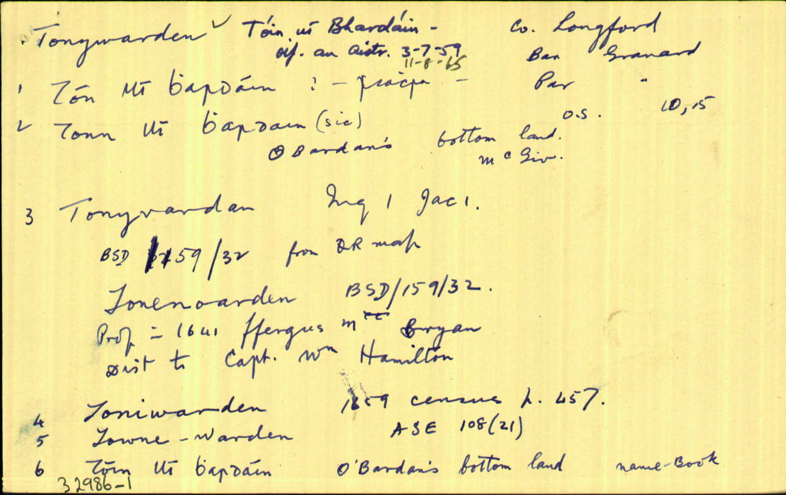
Tonyvardan
|
Inq. Lag. Leathanach: 1 Jac.1
|
| 1612 |
Tenivordan
|
Inq. Lag. Leathanach: 3 Jac.1
|
| 1612 |
Tonybarden
|
CPR Leathanach: 244b
|
| 1612 |
Tromroe
|
Inq. Lag. Leathanach: 3 Jac.1
|
| 1620 |
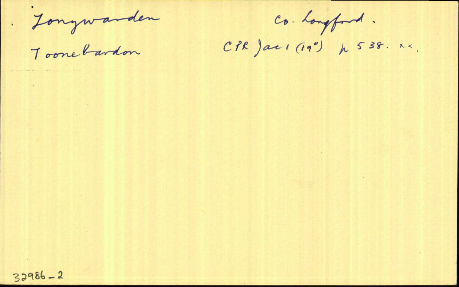
Toonebardon (Nicholas Archbald)
|
CPR Leathanach: 538a
|
| 1620 |
Tromroe
|
CPR Leathanach: 452a
|
| 1629 |
Tonebardan
|
|
| 1629 |
Tomroe
|
|
| 1632 |
Tromroe
|
Inq. Lag. Leathanach: 9 Car.1
|
| 1654-56 |
Tonninwarden in the barony of Granard
|
CS X Leathanach: 47
|
| 1655 |
Tonewarden
|
|
| 1659 |
Toniwarden
|
|
| 1659 |
Trumrae
|
|
| c.1660 |
Tonenoarden
|
BSD Leathanach: 159
|
| c.1660 |
Townywarden (Bryan ffarrell, I.P.)
|
BSD Leathanach: 161
|
| c.1660 |
Trumry
|
BSD Leathanach: 161
|
| 1671 |
Towne-Warden
|
ASE Leathanach: 108
|
| c.1699 |
Tomyvarde (Brian Farrell, gent)
|
Analecta Hib. Imleabhar: 22, Leathanach: 77
|
| 1703 |
Tonewarden
|
Trustees Leathanach: 360
|
| 1724 |
Trumrose
|
CGn. Leathanach: 45.39.27616
|
| 1765 |
Tonnywarden
|
CGn. Leathanach: 244.3.155548
|
| 1813 |
Tonywarden
|
|
| 1813 |
Trumroe
|
|
| 1836 |
Toneywarden
|
|
| 1836 |
Tonywarden
|
|
| 1836 |
Tonewarden
|
|
| 1836 |
Tonyvardan
|
|
| 1836 |
Tóin Ui Bhardáin, “O’ Bardan’s bottom lands”
|
|
| 1836 |
Trumroe
|
|
| 1836 |
Tromroe
|
|
| 1836 |
Tromra, “place of elder trees”
|
|
| 1836 |
Trum ruadh [scriosta]
|
|
| 1836 |
Tromra
|
|
| 1836 |
occurs frequently in other counties
|
|
| 1836 |
Trumroe
|
|
| 1836 |
Tromroe
|
|
| 1836 |
Trumroe
|
|
| 1837 |
The eastern fort in the Townland of Trumra is called Bawnkedy (Ceadach’s Bawn) and should be so called on the Ordnance map
|
LSO (Lo) Leathanach: 21
|
| 1908 |
Tonnywarden, Tonn Uí Bhardain, “O’ Barden’s bottom land”
|
MacGivney Leathanach: 218
|
| 1908 |
Tromera, Tromra, “where alder trees grow” .. “To the east of this townland is a fort called Ceadach Bán”
|
MacGivney Leathanach: 219
|
| 1965 |
Tóin Uí Bhardáin
|
|
| 2007 |
toniˑˈwɑrdən
|
Please note: Some of the documentation from the archives of the Placenames Branch is available here. It indicates the range of research contributions undertaken by the Branch on this placename over the years. It may not constitute a complete record, and evidence may not be sequenced on the basis of validity. It is on this basis that this material is made available to the public.
Archival and research material provided on this site may be used, subject to acknowledgement. Issues regarding republication or other permissions or copyright should be addressed to logainm@dcu.ie.
Permanent link
https://www.logainm.ie/32986.aspxOpen data
Application programming interface (API)
Available under
Creative Commons Attribution 4.0 International (CC BY 4.0)
API key required to access data
Linked Logainm
Formats: RDF | RDF N3 | RDF JSON | RDF XML
Operated by Digital Repository of Ireland