Hierarchy
county
barony
civil parish
townland
townland
Cill Chéile Uachtarach
genitive: Chill Chéile Uachtarach
(Irish)
Kilteel Upper
(English)
Hierarchy
county
barony
civil parish
Centrepoint
53.235, -6.51767latitude, longitude
Irish Grid (with letter)
Computing...
Irish Grid (without letter)
Computing...
Irish Transverse Mercator (ITM)
Computing...
Archival records
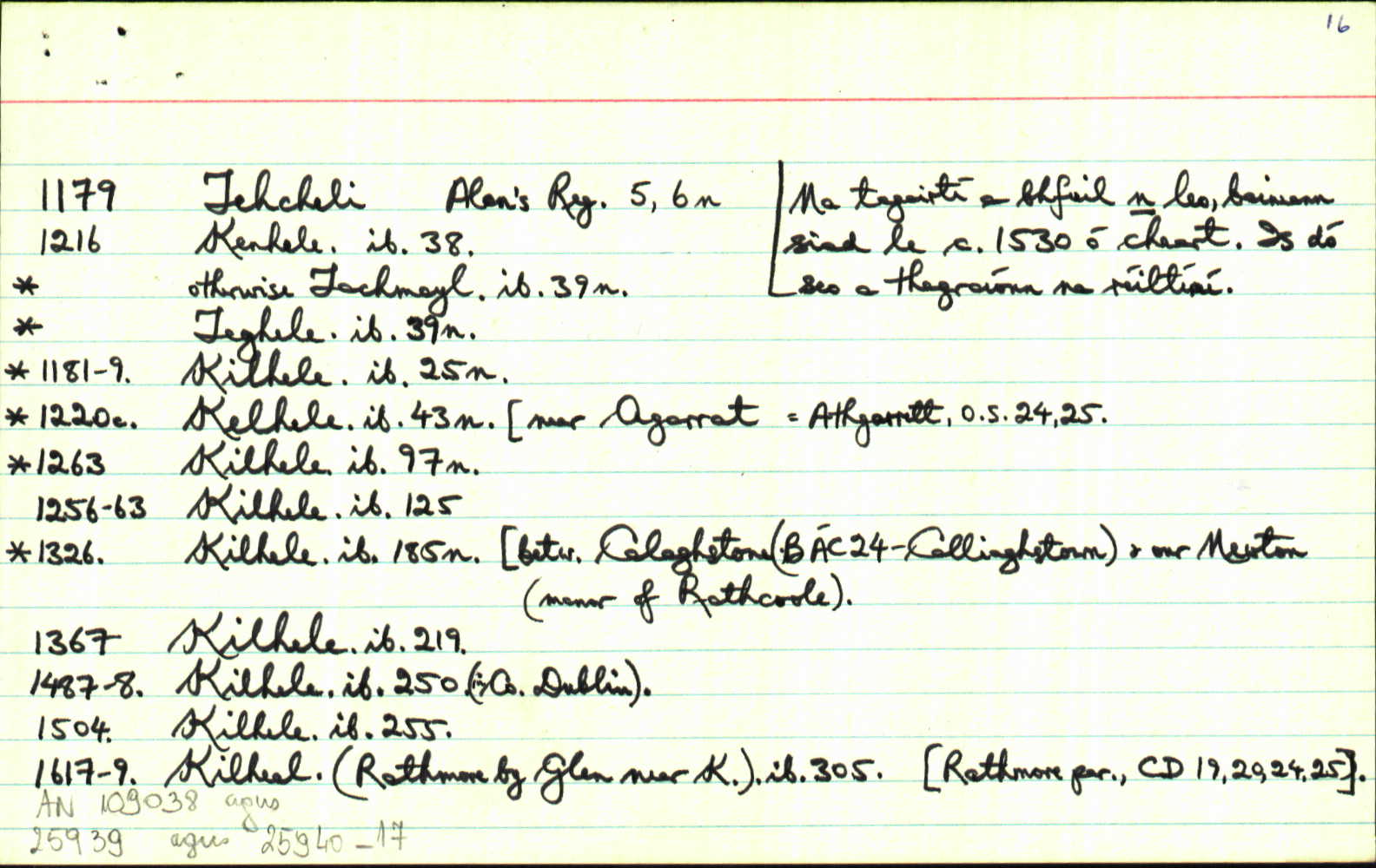

Historical references
| n/a |
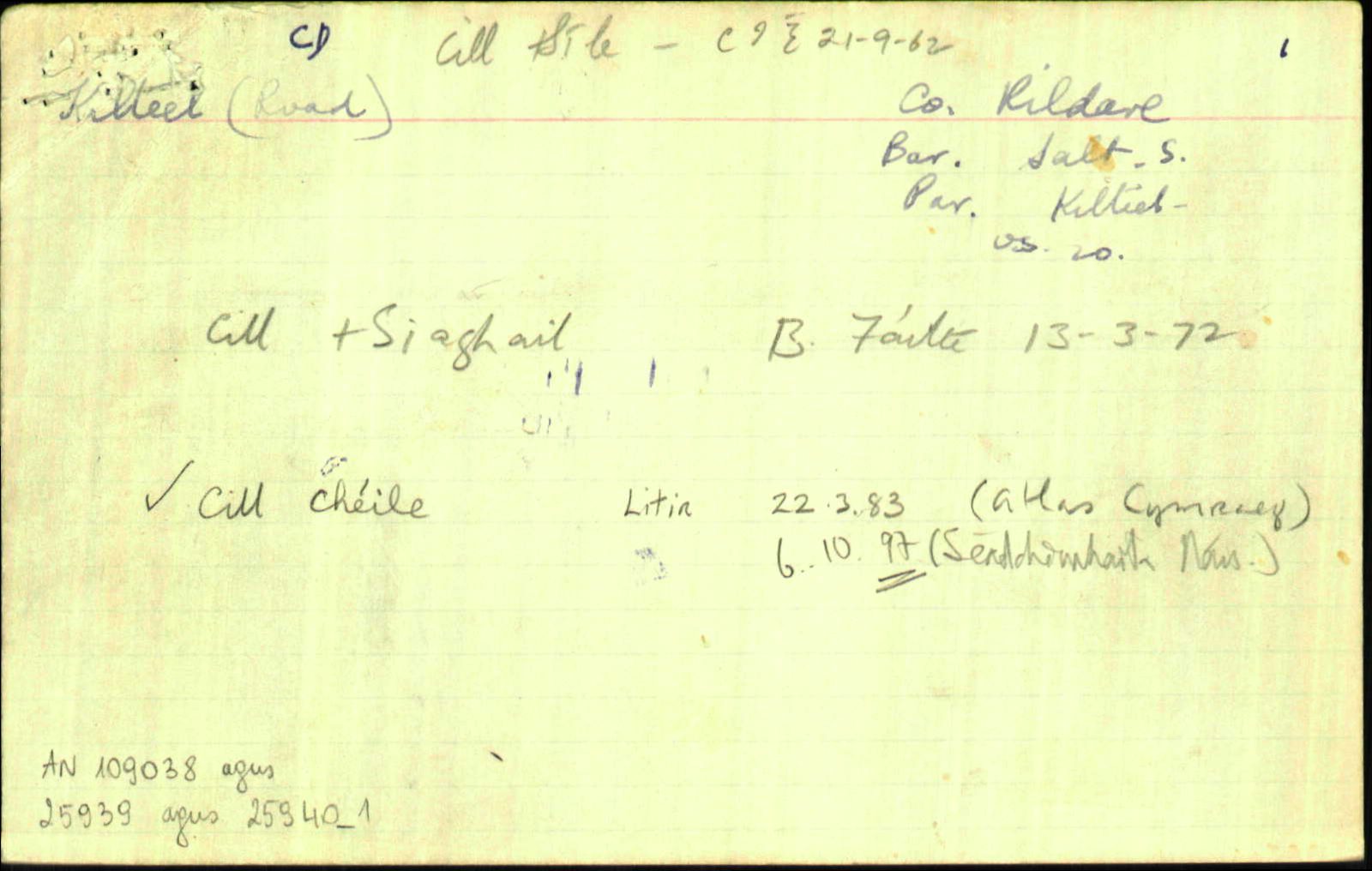
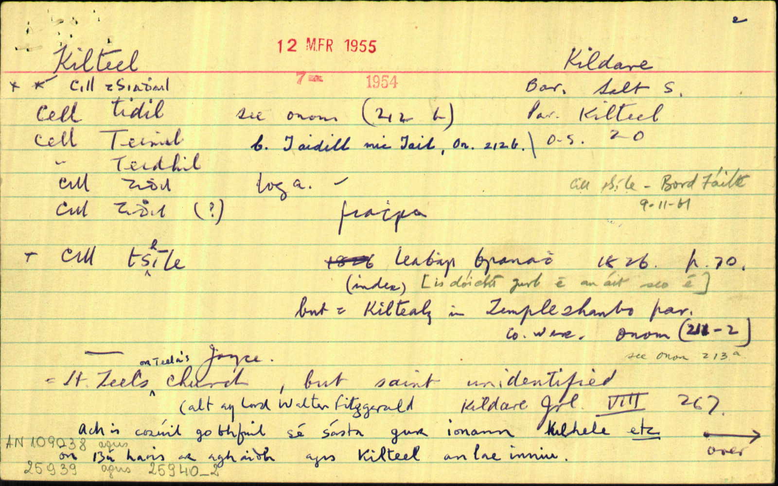
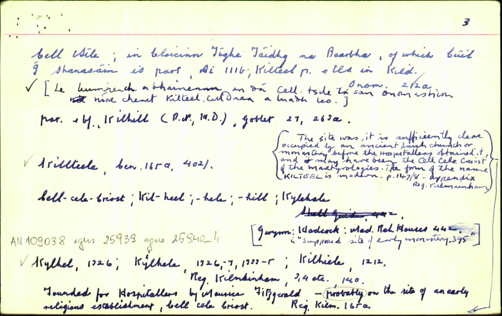
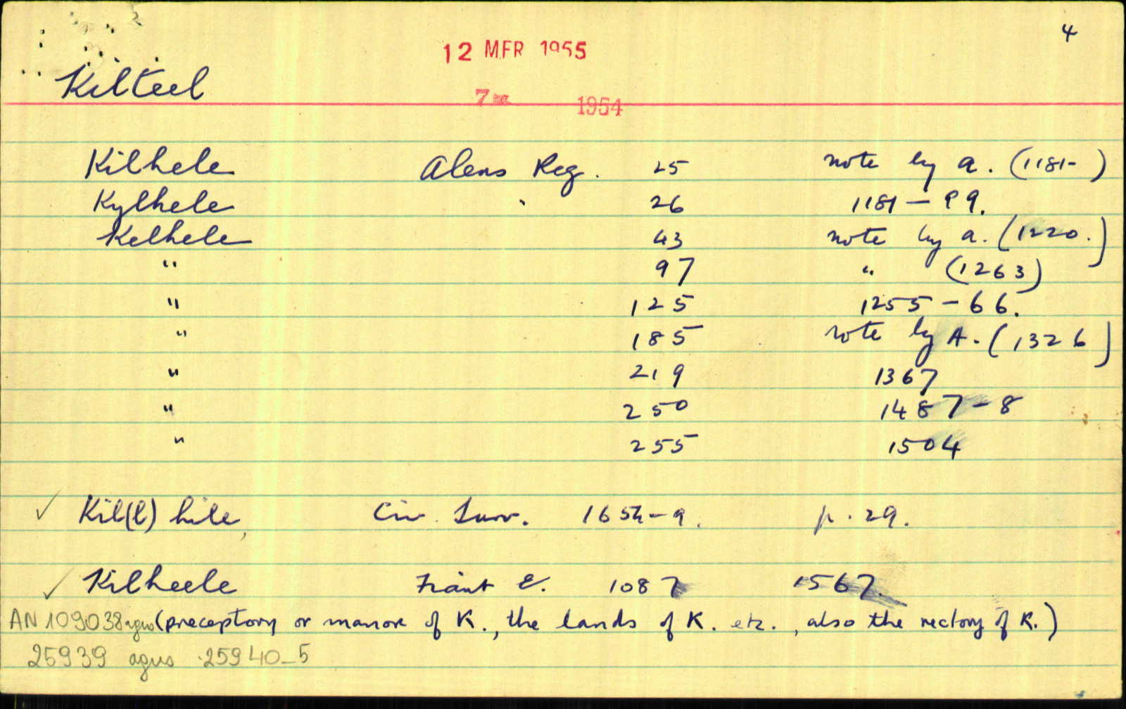
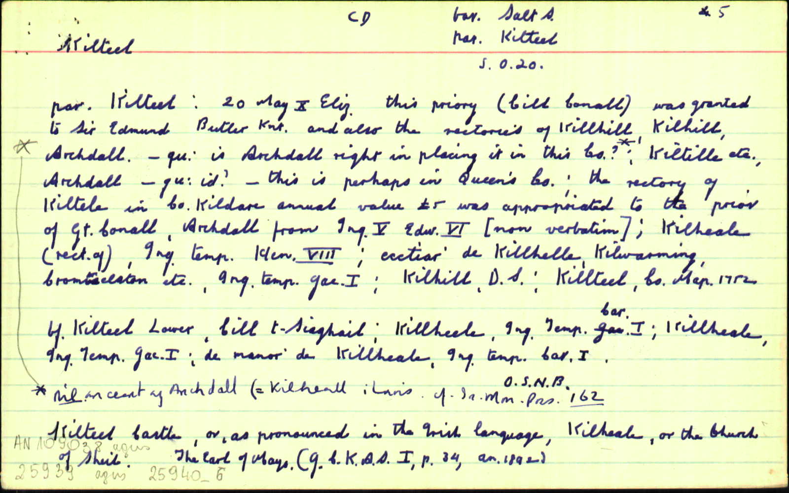
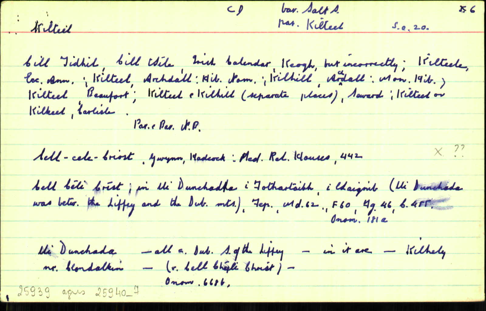
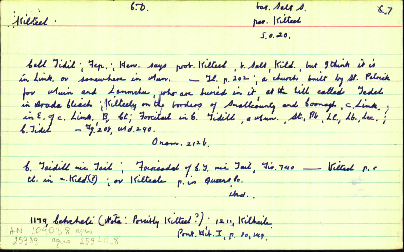
Cill tSíle
|
Celtica Imleabhar: 1, Leathanach: 75
Peritia Imleabhar: 3, Leathanach: 555
|
| 800c |
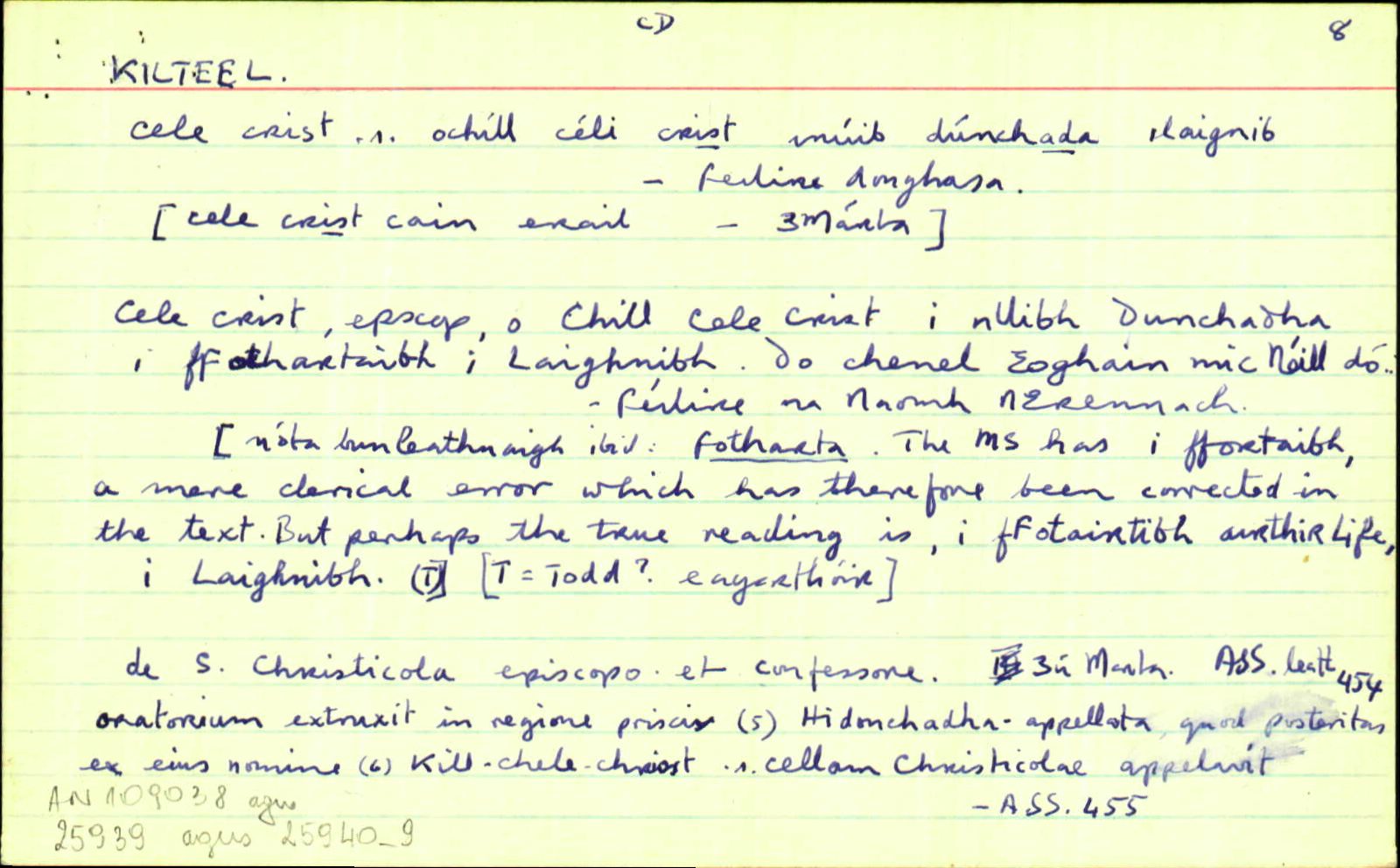
Céle Críst .i. o Cill Celi [Críst]
|
FOeng. Leathanach: 86
|
| 1170c |
Céle Crist epscop o Chill Cele Críst
|
FGorm. Leathanach: 46
|
| 1630c |
Cele Crist, epscop o Chill Cele Crist
|
FNÉ Leathanach: 62
|
| 1645 |
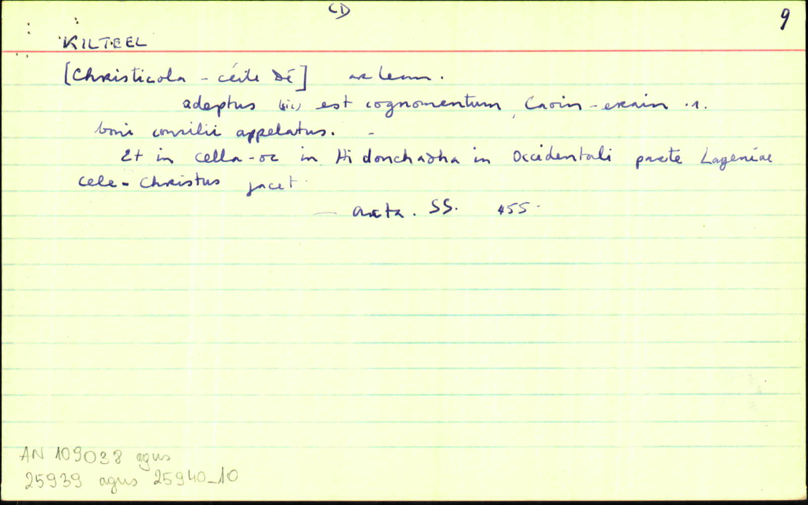
Kill-chele-chriost (Cele-Christus)
|
ASH Leathanach: 455
|
| 1650c |
Céle Criosd (easpog o Chill Criosd)
|
LGen. Leathanach: DF 702.7
|
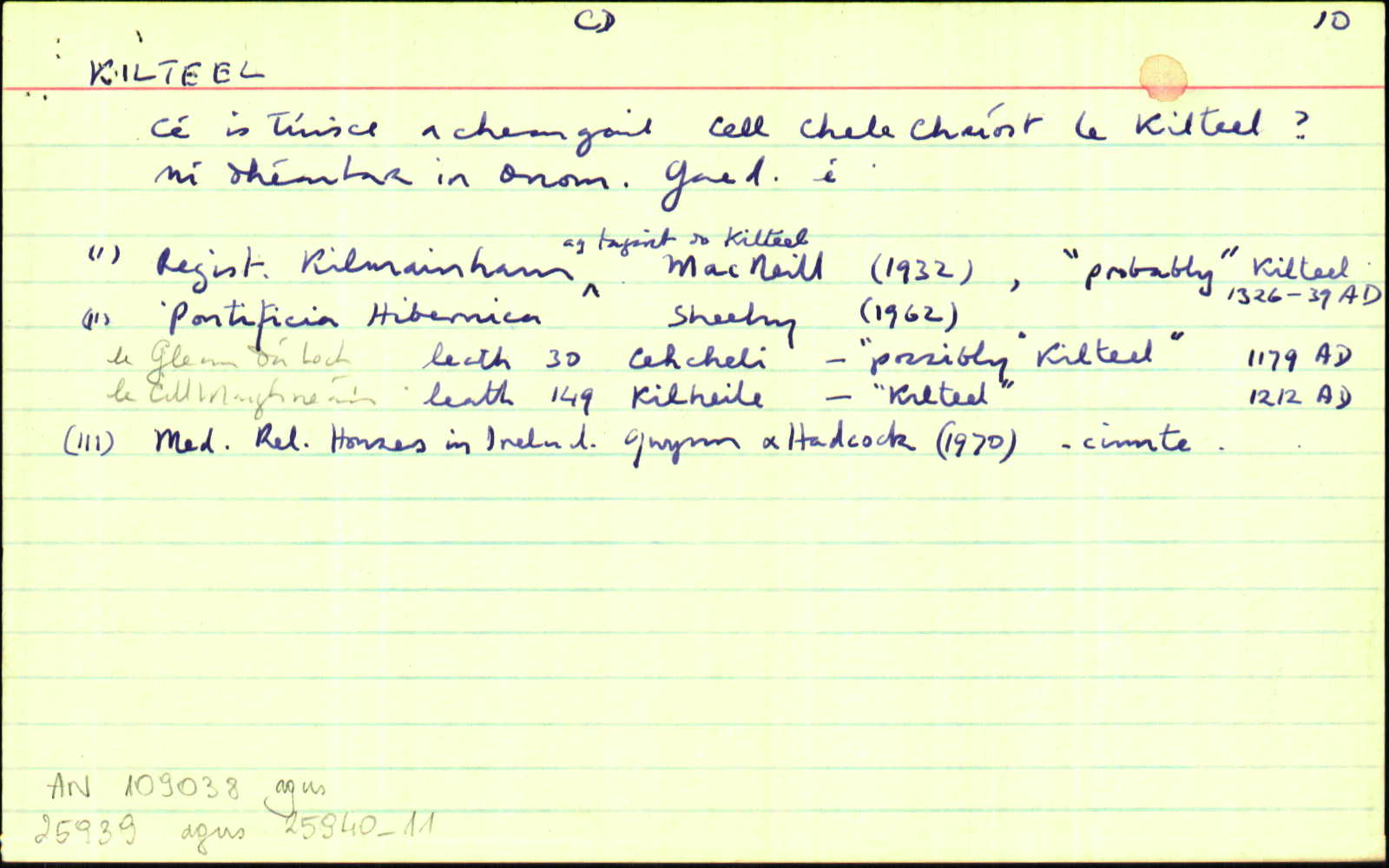
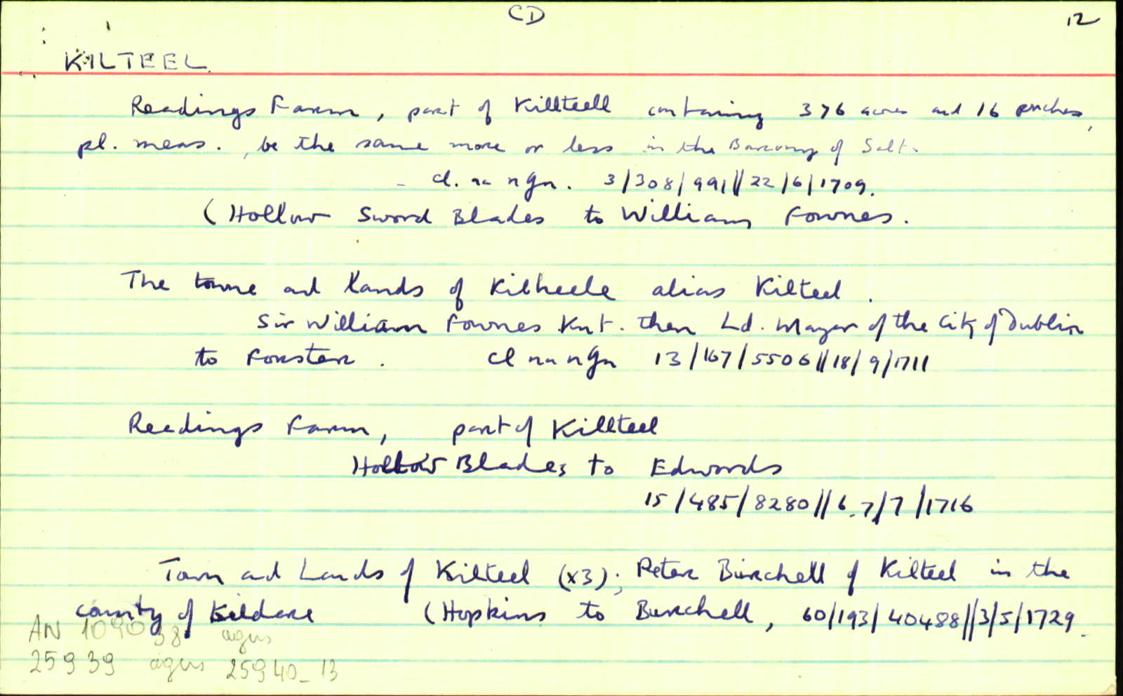
| 1709 |
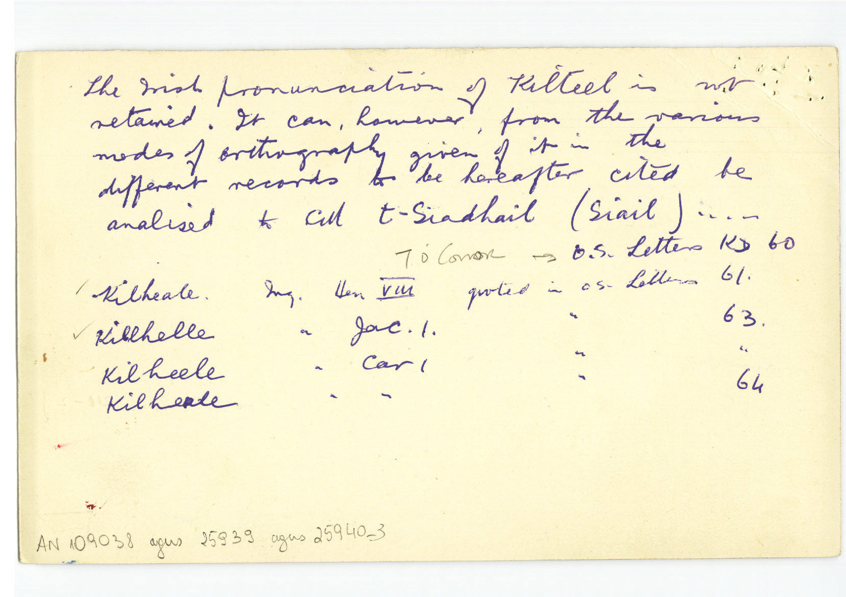
Killteell
|
CGn. Leathanach: 3.308.991
|
| 1711 |
Kilheele alias Kilteel
|
CGn. Leathanach: 13.167.5506
|
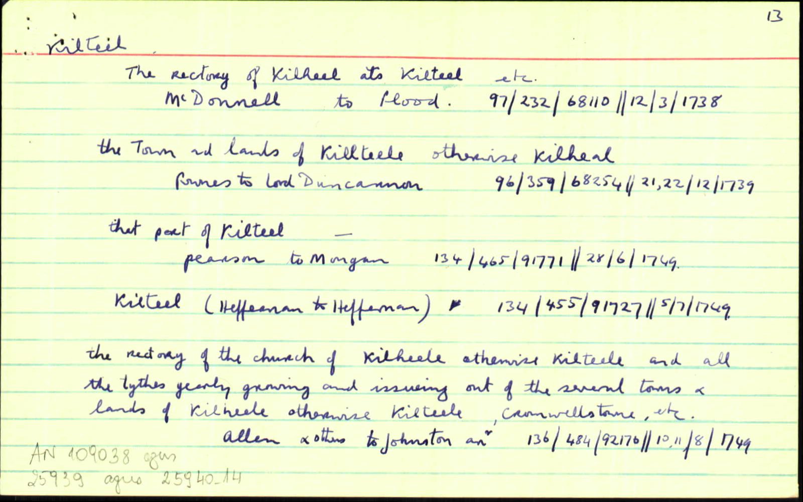
| 1738 |
Kilheel als Kilteel
|
CGn. Leathanach: 97.232.68110
|
| 1739 |
Killteele otherwise Kilheal
|
CGn. Leathanach: 96.359.68254
|
| 1749 |
Kilheele otherwise Kilteele
|
CGn. Leathanach: 136.484.92176
|
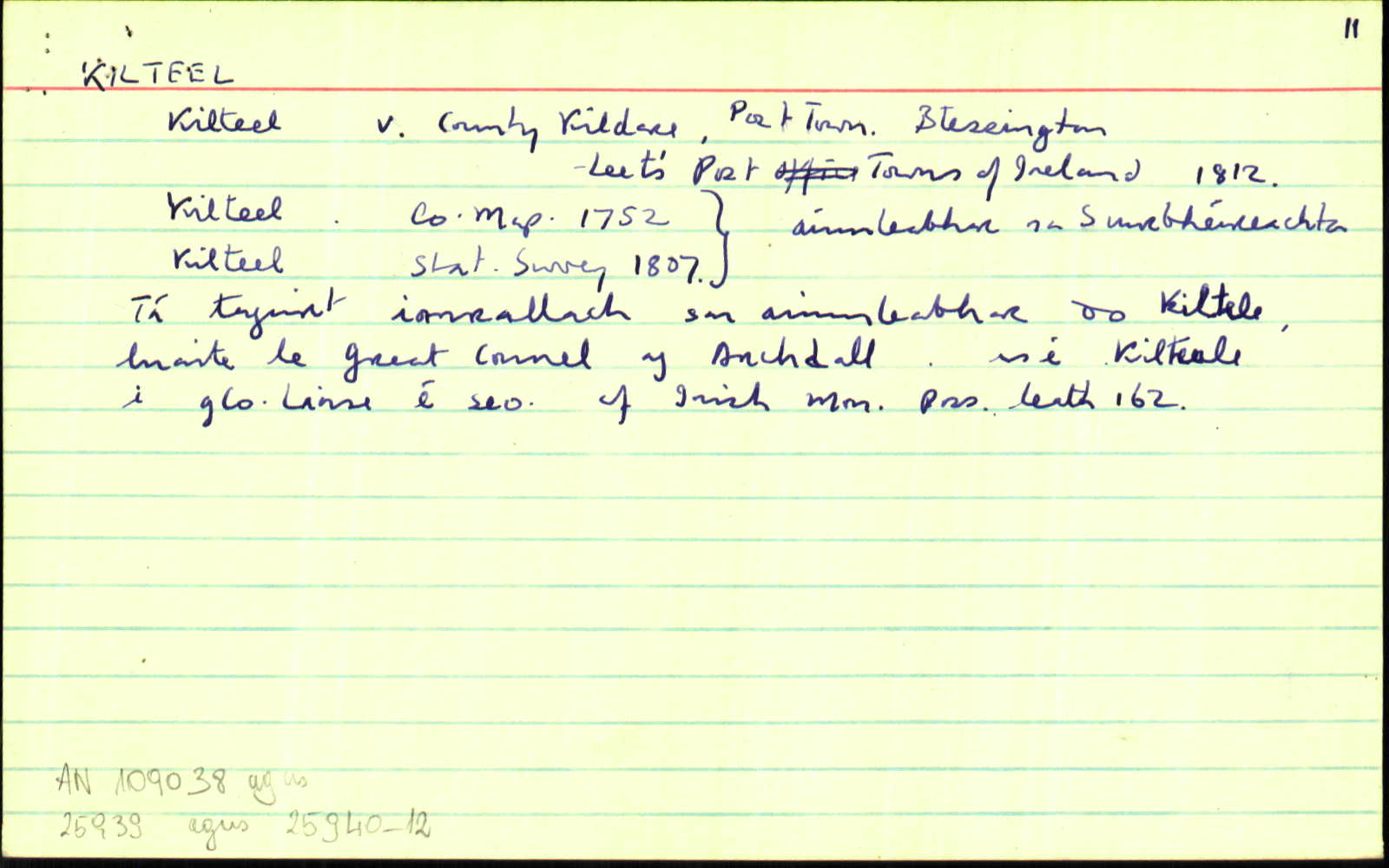
| 1752 |
Killteel
|
|
| 1755 |
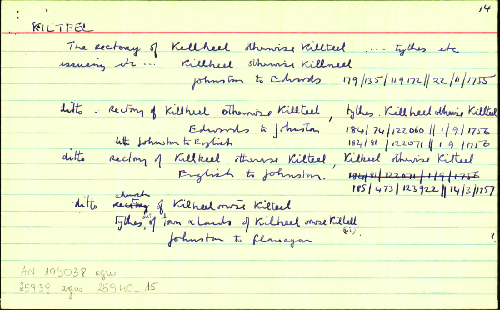
Killheel otherwise Killteel
|
CGn. Leathanach: 179.135.119172
|
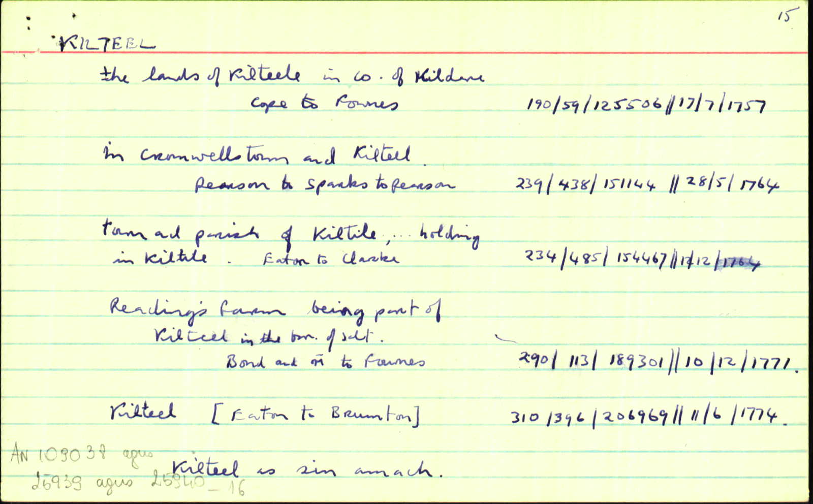
| 1807 |
Kilteel
|
Stat. Surv. (CD) Leathanach: xliii
|
| 1807 |
Kilteel
|
Stat. Surv. (CD) Leathanach: 218
|
| 1836 |
Kilteel
|
Stat. Survey (CD):AL Leathanach: 1,16
|
| 1836 |
Killteel
|
Map of Kildare 1752:AL Leathanach: 1,16
|
| 1836 |
Upper Kilteel
|
Cloncurry, Lord:AL Leathanach: 1,16
|
| 1836 |
Upper Kilteel
|
Ponsonby, Hon. F.:AL (CD) Leathanach: 1,16
|
| 1836 |
Upper Kilteel
|
White:AL Leathanach: 1,16
|
| 1836 |
Upper Kilteel
|
OD:AL Leathanach: 1,16
|
| 2008 |
Ceall Chéile Chríost
|
FSÁG Leathanach: 141, Imleabhar: 3
|
| 2009-2010 |
kiltiːlˈopər
|
Please note: Some of the documentation from the archives of the Placenames Branch is available here. It indicates the range of research contributions undertaken by the Branch on this placename over the years. It may not constitute a complete record, and evidence may not be sequenced on the basis of validity. It is on this basis that this material is made available to the public.
Archival and research material provided on this site may be used, subject to acknowledgement. Issues regarding republication or other permissions or copyright should be addressed to logainm@dcu.ie.
Permanent link
https://www.logainm.ie/25940.aspxOpen data
Application programming interface (API)
Available under
Creative Commons Attribution 4.0 International (CC BY 4.0)
API key required to access data
Linked Logainm
Formats: RDF | RDF N3 | RDF JSON | RDF XML
Operated by Digital Repository of Ireland