Hierarchy
county
barony
civil parish
townland
townland
Cill tSearcon Thiar
genitive: Chill tSearcon Thiar
(Irish)
Kilsarkan West
(English)
Hierarchy
county
barony
civil parish
Centrepoint
52.1563, -9.43231latitude, longitude
Irish Grid (with letter)
Computing...
Irish Grid (without letter)
Computing...
Irish Transverse Mercator (ITM)
Computing...
Archival records
Historical references
| n/a |
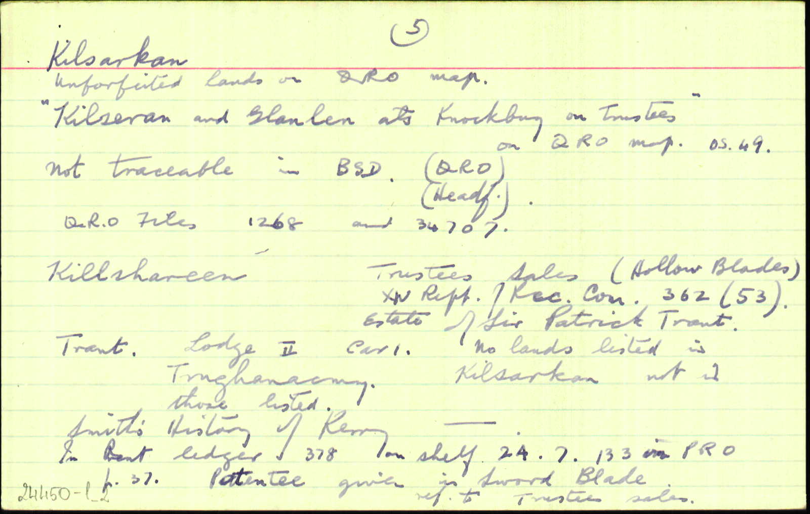
Cárta: Unforfeited lands on QRO Map. “Kilseran and Glanlen als. Knockbuy on Trustees” on QRO Map.O.S. 49.
|
|
| n/a |
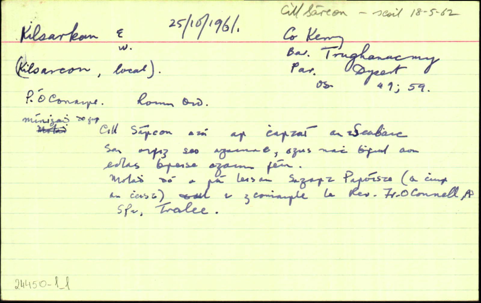
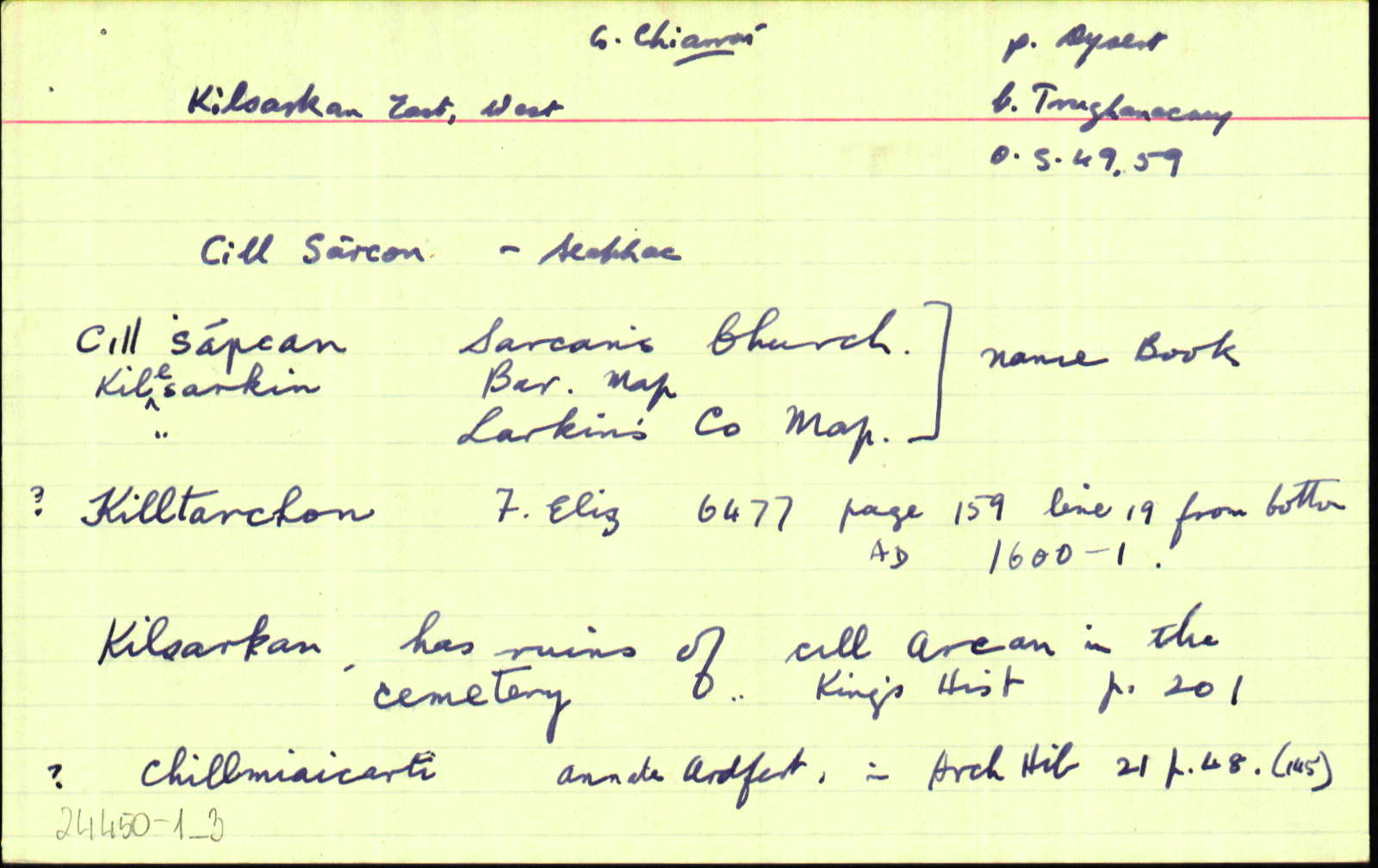
An Seabhac: Cill Sárcon Thoir/Thiar -- Tá iarsma na sean-chille agus an reilig sa chuid thoir. Lios na Scuab sa chuid thiar.
|
|
| 1572 |
Kiltarcon
the Rimors' lands
|
Cal. Carew Imleabhar: I, Imleabhar: 414
|
| 1584 |
Kiltarcon
'Conogher O'Dalye of ...'; Inquisition Exchequer Eliz
|
Kerry Arch.M Imleabhar: II, Leathanach: 271
|
| 1586 |
Kyltercon
another parcel of land lying on the mountain of Slewlogher and usually demised to the said late Earl rhymers,
|
Desm. Surv. Leathanach: 14
|
| 1586 |
Kyletercon, Killtarkan
And the Rhymer of Kyletercon in the mountain of Slewlogher
|
Desm. Surv. Leathanach: 16
|
| 1592 |
Kiltoghercon
|
Ériu Imleabhar: 43, Leathanach: 178
|
| 1601 |
Killtarchon
Coconnaght m' Molaghlin oge O Dalie
|
F Alt: 6477
|
| 1685 |
Killsaran
|
|
| 1703 |
Killshareen
|
Forf. Est. Leathanach: 362, Alt: 53
|
| 1710 |
Killsarcan
|
CGn. Leathanach: 522.1244, Imleabhar: 4
|
| 1710 |
Killsarcan
|
CGn. Leathanach: 171.1702, Imleabhar: 6
|
| 1716 |
Killsarcan
|
CGn. Leathanach: 478.8280, Imleabhar: 15
|
| 1719 |
Killsarcan
|
CGn. Leathanach: 9.13081, Imleabhar: 25
|
| 1735 |
Kilsarcan
|
CGn. Leathanach: 59.57540, Imleabhar: 83
|
| 1804 |
Killsarcan
|
CGn. Leathanach: 59.379372, Imleabhar: 570
|
| 1825 |
Kilsarcon
|
|
| 1841 |
Kilsarkan West
|
BS:AL Leathanach: Ci045,12
|
| 1841 |
Killsarkin West
|
BM:AL Leathanach: Ci045,12
|
| 1841 |
Killsarkin West
|
Larkin (Ci):AL Leathanach: Ci045,12
|
| 1841 |
[Killsarkin West]
"There are 3 Danish forts in this townland viz. 'Lissavoher,' 'Lissnascoube' and 'Lisshemusadonagha'."
|
Desc. Rem.:AL Leathanach: Ci045,12
|
| 1841 |
The ruins of an old church are situated in the North West end of the Townland of Kilsarkan
|
LSO (Ci) Leathanach: 207 / 495
|
| 1841 |
Killsarkin East
|
Bar. Map:AL (Ci) Leathanach: Ci045,11
|
| 1841 |
Kilsarkan East
|
BS:AL Leathanach: Ci045,11
|
| 1841 |
Killsarkin East
|
Larkin (Ci):AL Leathanach: Ci045,11
|
| 1841 |
Kilsarkan etc.
|
OC:AL Leathanach: Ci045,11
|
| 1841 |
Cill Shárcan, 'Sarcan's church'
|
OD:AL Leathanach: Ci045,11
|
| 1841 |
Cill Sharcan
[glanta]
|
pl:AL Leathanach: Ci045,11
|
| 2017 |
ˌkilˈsɑːrkən
|
Áit. Uimhir : 170717, Cainteoir: 004
|
Please note: Some of the documentation from the archives of the Placenames Branch is available here. It indicates the range of research contributions undertaken by the Branch on this placename over the years. It may not constitute a complete record, and evidence may not be sequenced on the basis of validity. It is on this basis that this material is made available to the public.
Archival and research material provided on this site may be used, subject to acknowledgement. Issues regarding republication or other permissions or copyright should be addressed to logainm@dcu.ie.
Permanent link
https://www.logainm.ie/24451.aspxFolklore
The National Folklore Collection (dúchas.ie) contains material related to this place:
Open data
Application programming interface (API)
Available under
Creative Commons Attribution 4.0 International (CC BY 4.0)
API key required to access data
Linked Logainm
Formats: RDF | RDF N3 | RDF JSON | RDF XML
Operated by Digital Repository of Ireland